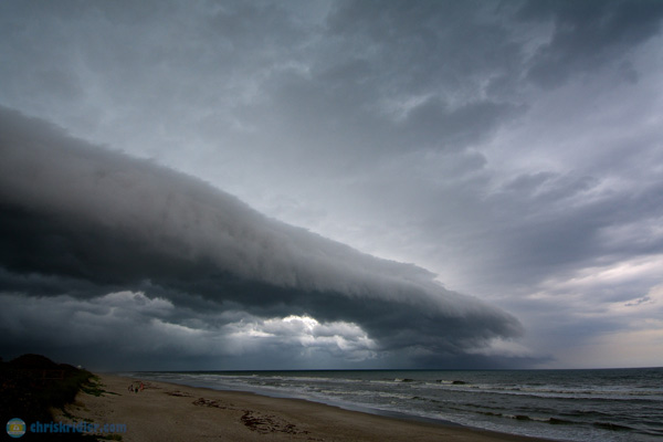
The tail end of the outflow boundary/shelf cloud wasn’t as impressive as the rest, but it was still pretty. Photo by Chris Kridler, ChrisKridler.com, SkyDiary.com

The tail end of the outflow boundary/shelf cloud wasn’t as impressive as the rest, but it was still pretty. Photo by Chris Kridler, ChrisKridler.com, SkyDiary.com
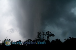
The severe storm sure was scary looking – presenting a great faux tornado. Photo by Chris Kridler, ChrisKridler.com
Several storms in a bowing line prompted tornado warnings, so I went to track them down and met the line on S.R. 520 – west of the St. John’s River but south of 528.
I was quite close to one of the warned circulations, as the radar image shows, and even saw a Scary Looking Cloud that had a great tornado look about it – but was really an optical illusion as the leading edge of the bow passed by.
Roll over a photo to see its caption, and click on any of the pictures to start a slide show of larger images.
I’ve photographed not-so-great shots of the moon with a thunderstorm before, but nothing like this. Better yet, there were multiple shots, though the lead one shown here is definitely my favorite.
Meanwhile, prints of this photo (and other lightning images) can be ordered here.
Roll over a photo to see its caption, and click on any of the pictures to start a slide show of larger images.
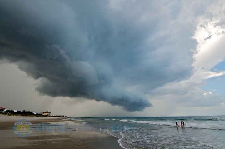
This is where the storm started to get dreamy, though I was somewhat concerned for the waders. Photo by Chris Kridler, ChrisKridler.com
The beaches have been under siege here in Brevard County for the past couple of days as ominous shelf clouds have swept over the sun-worshipers and surfers, harbingers of downpours and lightning close behind. I’ve caught photos in the past couple of days at Cocoa Beach and Satellite Beach. In both places, some folks didn’t seem to be in a hurry to escape the lightning danger, which was high. I take a risk, too, when I stand on the beach to shoot a photo, and I’m well aware of it.
Today’s storm over Satellite Beach was especially beautiful. As dangerous as the lightning might have been, I couldn’t look away. See all the 2013 chase reports here.
Still need a beach read for this summer? My storm-chasing adventures, “Funnel Vision” and “Tornado Pinball,” are just $3.99 as e-books. They’re also in paperback. Check ’em out. (You can quite literally check them out of the Brevard libraries, too.)
Roll over a photo to see its caption, and click on any of the pictures to start a slide show of larger images.
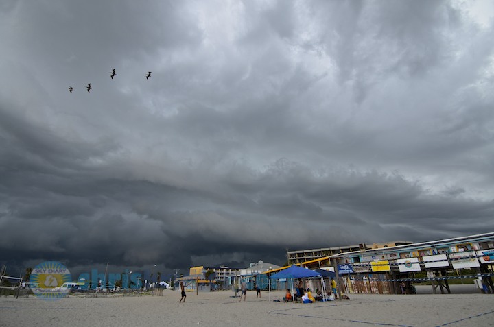
The line approached Cocoa Beach Pier. Photo by Chris Kridler, ChrisKridler.com
Boundary collisions were evident on radar the afternoon of July 21, leading to storms, but I waited until they were well under way and a severe storm warning was issued before I headed out to take a look.
I stayed ahead of a pretty but fragmented shelf cloud from Merritt Island into Cocoa Beach, Florida. Shelf clouds always seem to reach their majestic maturity when they hit the beach.
Roll over a photo to see its caption, and click on any of the pictures to start a slide show of larger images.
I love a nice shelf cloud, and I’ve missed a few of them this season. Florida always has more, though, and I caught one this afternoon as a pretty line of storms rolled through Brevard County.
Storms set up in a line moving northeast across Brevard County, Florida, today. An outflow boundary was evident on radar, resulting in an undulating shelf cloud of varying drama. I stayed ahead of the line from Rockledge to Port Canaveral, snapping photos along the way.
Roll over a photo to see its caption, and click on any of the pictures to start a slide show of larger images.
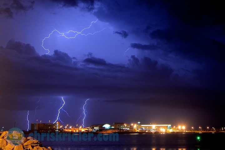
The best bolts were ending just as I got set up at Port Canaveral – of course. Photo by Chris Kridler, SkyDiary.com, ChrisKridler.com
While the lightning wasn’t so close that it sizzled, I did catch a few bolts in an atmospheric setting.
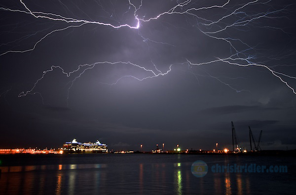
A lightning crawler lights up the sky over Port Canaveral on April 29, 2013. Photo (c) Chris Kridler, ChrisKridler.com, SkyDiary.com
I chased a severe storm the evening of April 29 in hopes of catching a little lightning. I got lucky with this shot over Port Canaveral, Florida, with a cruise ship in the foreground.
My Tornado Alley chase is on hold (shades of 2012) while the pattern continues to be un-May-like in the Plains. So any storms I get to see in Florida are a bonus.
Meanwhile, please consider subscribing to my YouTube channel. I’ve adopted the new layout, which better organizes my videos, and you’ll be able to keep track of my storm chases when I post new ones as I travel.
Roll over a photo to see its caption, and click on any of the pictures to start a slide show of larger images.
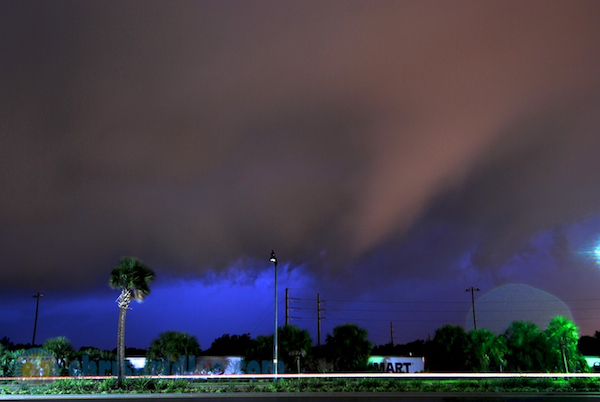
A suspicious lowering was a persistent feature of a tornado-warned storm as it approached me in Rockledge, Florida, on April 14. Photo by Chris Kridler, ChrisKridler.com
I decided to chase a decent chance of severe storms in central Florida on April 14, with at least the hope of testing my storm-chasing gear. That still needs work – and the first part of the chase was frustrating. The second was fueled with adrenaline.
Earlier in the day, I gave the Midland USA XTC-300 wearable camera a tryout during the storm-chase in central Florida on Sunday, in preparation for using it in Tornado Alley. In this short video, time-lapsed in editing, it was attached to my car with a suction-cup mount and stood up to highway speeds and rain. Video by Chris Kridler; music licensed from FootageFirm; camera courtesy Midland USA.
Sunday night, when a tornado-warned storm approached my neighborhood – with lots of attendant lightning – I decided to take a chance and see what I could get. Mostly, I wanted lightning, but the persistent rain made it hard to get a clear shot. However, I found myself in the path of a tornado-warned storm headed for Rockledge, Florida, and according to the radar, I was really in the path. The “hook echo” was pronounced and on track to collide with me. So I watched and photographed the storm with nervous anticipation.
What I saw at the time and in my photos was, shall we say, suspicious. Again, chasing at night, it’s very difficult to see and identify significant features such as funnels and tornadoes, when so-call scud clouds can mimic them easily. Yet the persistent feature in this photo (in several photos, actually) sure looked like a funnel.
The National Weather Service says there were likely two tornadoes, including one in Cocoa produced by the storm that spawned what I think was a funnel in my photographs.
Roll over a photo to see its caption, and click on any of the pictures to start a slide show of larger images. Note: Post updated with images from my old Sky Diary site.
The chill has lasted longer than usual this winter here in Florida, but at least we’re not experiencing snowstorm after snowstorm. What we did get was a blast of wind in a squall line Sunday, March 24. I drove out to meet it west of Cocoa.
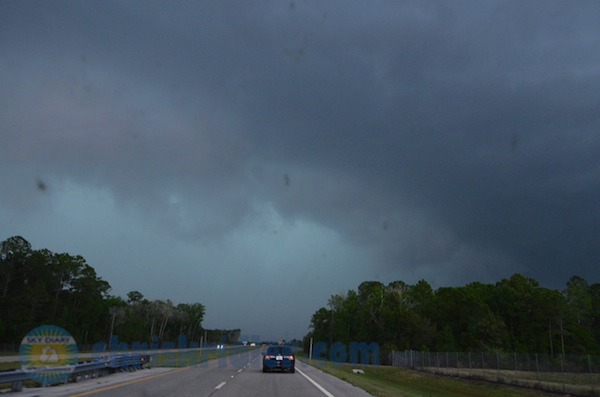
I went out to meet a squall line racing across Florida on March 24, 2013, and got a quick shot through the windshield before it overtook me. This was in the vicinity of S.R. 528 and S.R. 520, west of Cocoa, Florida.
It was moving so fast (warned with a motion of 55 mph), I couldn’t reach the area of rotation. I didn’t even have time to set up and get nice photos of the green gust front. But I did get video in my car as it blasted me.
Despite tornado warnings, the National Weather Service found only straight-line wind damage in its survey.
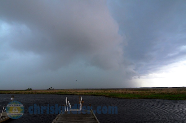
At the boat ramp across from Lone Cabbage Fish Camp, I barely had time to shoot another photo of the incoming squall line before it hit me again. At least I got a little video.
It’s not long now until the May chase! Want to see more stormy images? If you’re on Florida’s Space Coast, get a look at my storm photography on exhibit at Titusville’s Downtown Gallery, 335 S. Washington Ave. (321-268-0122), through April 16. There, you can also pick up copies of my Storm Seekers novels, Funnel Vision and Tornado Pinball – or get them online.
I’m also speaking about storm chasing and signing books at Cocoa Beach Library on April 6 at 2 p.m. The program is free.
Late edit: Just added an event – a book signing the evening of April 6 at Coco’s during Cocoa Village’s gallery walk.
Note: Post updated with images from the old Sky Diary site.
