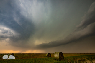
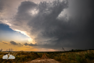
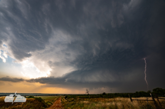
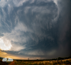
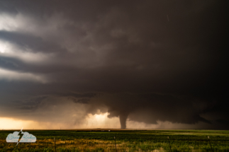
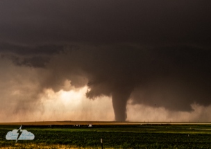
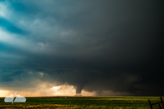
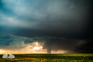
We started May 23 with casual optimism about our chase prospects. The fun part was that Alethea Kontis and I were storm chasing with Jason Persoff and Dave Lewison (Bill Hark had ended up elsewhere the previous day, but he would get great close-up views of what was to come). And we were chasing dryline storms, which I enjoy. I can’t say our expectations were high; the Storm Prediction Center had outlooked a 5 percent tornado risk over a long vertical swath along the dryline and north, encompassing much of western Oklahoma, central Kansas and eastern Nebraska, but we had no idea what a spectacular day would unfold.
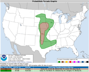
The Storm Prediction Center issued a slight risk of severe storms that included southwestern Oklahoma with a 5 percent tornado risk.
We aimed for northwest Oklahoma first and got partway there, ran into chaser friends and waited for a bit. I had increasing levels of anxiety as I watched the storms that formed farther south showing supercellular characteristics on radar. Fortunately, Jason and Dave were thinking the same thing, so we made the decision to head that way. Sometimes you stick to your initial target for good reasons, but as the day wears on – we’d passed 5 p.m. – you chase what presents itself. Thank goodness we did.
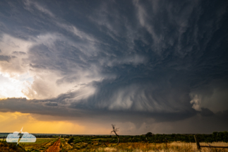
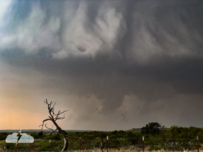
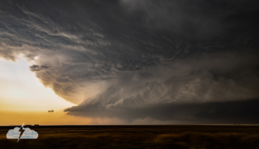
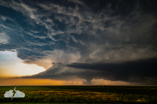
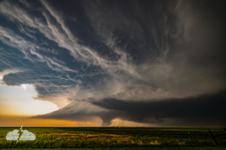
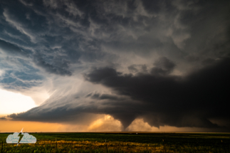
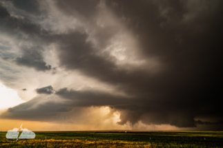
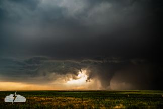
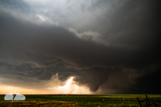
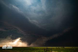
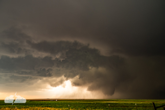
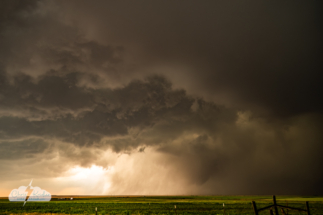
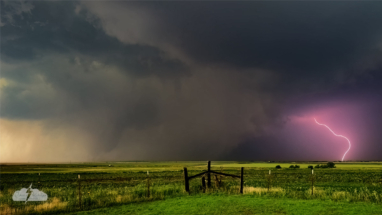
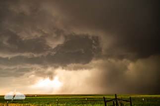
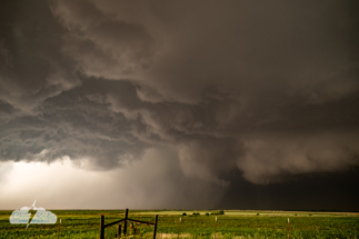
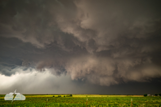
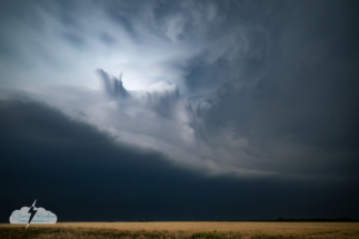
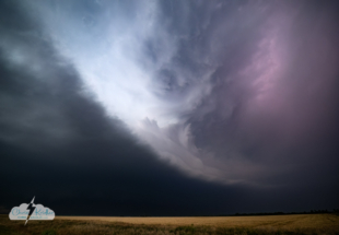
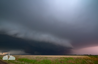
We stopped west of Duke to survey an approaching supercell near Hollis, peering through humid, dusty, hazy air. The photos show how weird and dreamlike it appeared. It hadn’t yet started to spin like mad. It took a collision of cells to do that.
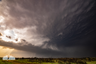
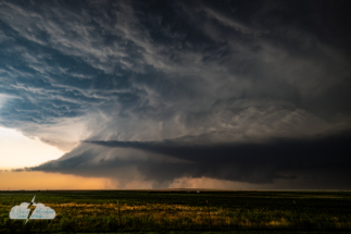
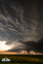
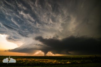
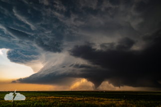
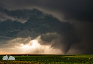
Our two vehicles repositioned south to different locations as our target storm approached. Alethea and I found a spot atop a hill on an atmospheric red-earth road off Route 34 that offered an amazing view as the storm tightened up and its structure evolved into a layered spinning top. It almost tornadoed, producing a scuddy lowering. But as the cell eased closer and we started to get pinged by hail, we made the decision to back off a bit down to Route 6, which, as any chaser knows who was there that day, was closed eastbound for construction. Argh!
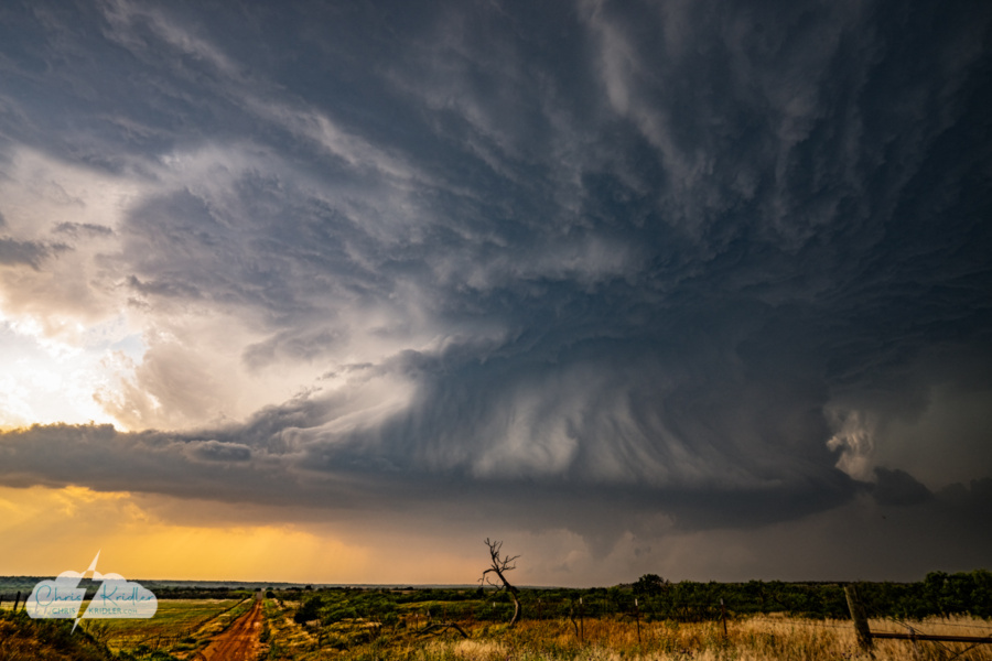
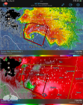
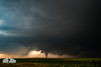
We thought the storm might be on the verge of a tornado at 6:42 p.m.
In hindsight, we probably would have had a great close-up view where we were (extremely close!), or at least on Route 6, but after meeting up with Jason and Dave again just south of Route 6, we made the choice to get more directly east of the meso and get a clearer view of the potential tornado with the magnificent structure. The worst part of that decision was the risk – not of danger but of the possibility of missing everything.
As the storm sucked in air from the south, blowing dust obscured the base so much that flying brown dirt was about all you could see until we got farther east. So while eyeing the radar and seeing tornado/funnel reports on SpotterNet, I yelled “We’re missing it!” as I drove behind Jason and Dave in our quest to get east and then north. Alethea had to put up with my crankiness.We missed perhaps 15 to 18 minutes of the tornado in progress, though I did get a snapshot out the window of the storm with a young tornado under it as we zoomed east. But what we saw from Olustee would be incredible as it continued for another half hour.
As we repositioned, we danced with lots of other chasers and research crews and mobile radars as they scrambled all over the grid of roads — mostly gravel, with rare paved options that Dave figured out — trying to find their viewpoint of choice. NSSL’s Low-Level Internal Flows in Tornadoes experiment (LIFT) got data around the storm with mobile radar and Doppler lidar. A Texas Tech mobile Doppler got data from within a mile of the tornado. And other research groups were on this tornado, too — the National Severe Storms Laboratory reported there were at least five mobile radars on the job, plus drones.
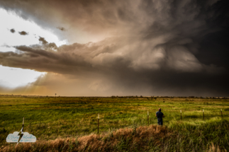
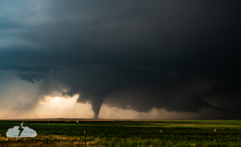
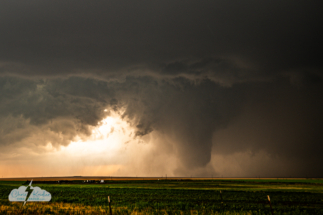
Yet as we buzzed into Olustee and beelined for the western edge of town, where we could clearly see a multivortex tornado in progress to the west, our group was alone for the moment. Well, alone with the townsfolk and a clear view over the Plains. It’s a rarity to view any storm these days in a quiet place without lots of storm chasers around you.
I pulled beyond and to the left of Jason and Dave, figuring I’d be out of the way, out of their direct line of sight, and they could always come forward a few steps. They both had the brilliant idea of photographing the storm with my car in the foreground, and the results were very cool – the CR-V appears tiny against the backdrop of the magnificent supercell.
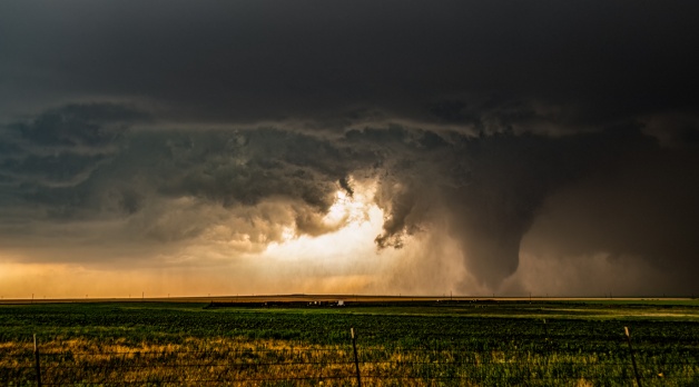
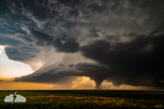
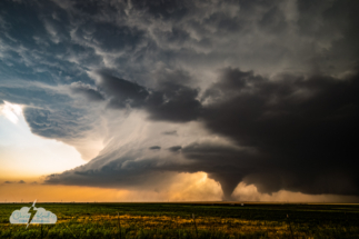
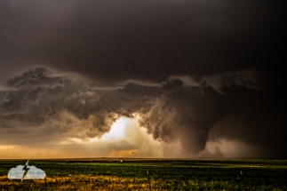
The supercell looked like something out of a dream, thanks to dust and distance (5 miles?), and I made a choice in editing the photos to “dehaze” and bump up the clarity and contrast to bring out its features. It cycled from one tornadic shape to another – multivortex, cone, stovepipe, wedge – appearing to dissipate and reappearing again.
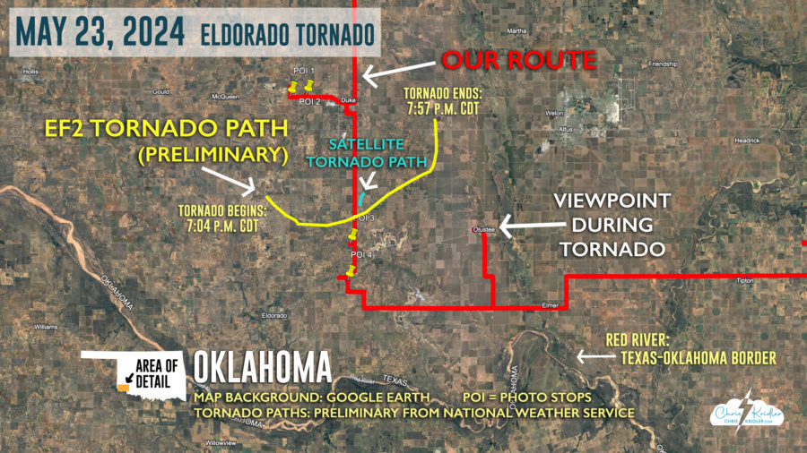
At one point, a second, smaller tornado was on the ground to the northwest of the main one. This satellite tornado damaged a home, the National Weather Service later found. Its preliminary rating was EF0.
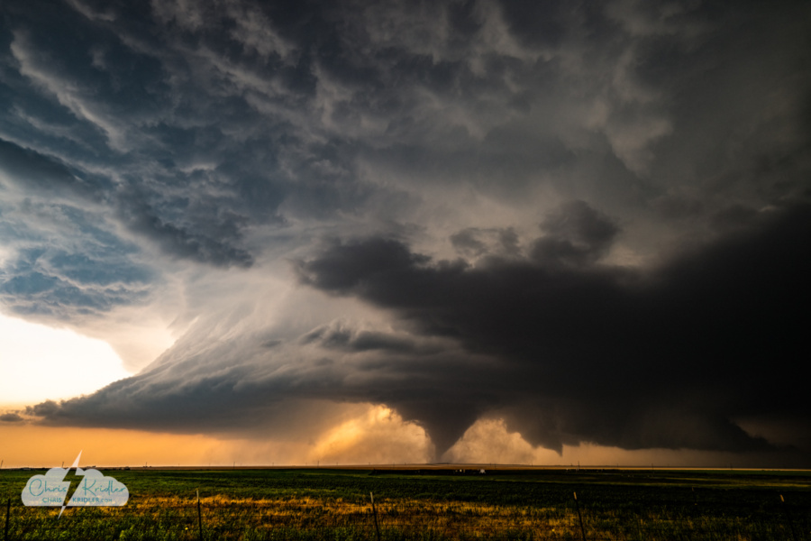
A second tornado appeared behind the first. The satellite tornado damaged a house.
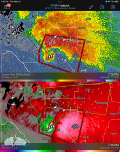
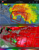
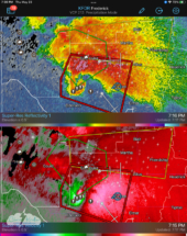
The National Weather Service issued continuous warnings of the tornado, first radar-indicated, then confirmed: “At 705 PM CDT, a confirmed large and extremely dangerous tornado was located 6 miles north of Eldorado, moving east at 5 mph.” The tornado damaged several barns and at least half a dozen houses in Jackson County, but at least it wandered in a sparsely populated area, and I’ve found no reports of injuries.
While the damage was rated EF2, which the National Weather Service attributed to power poles being “snapped,” actual wind speeds recorded by mobile radars suggest the tornado’s winds could have been in the 180 mph range, or EF4, NSSL reported — IF wind speeds were used in ratings. Which they aren’t. Ratings on the Enhanced Fujita Scale are based on damage.
And this tornado was on the ground for 53 minutes, according to the National Weather Service summary, tracking across 15 miles, from 8 miles southwest of Duke, crossing north of Eldorado, and ending about 5 miles east-southeast of Duke. It grew to more than a mile wide at one point and was beautifully visible from our position on the west edge of Olustee, which was eventually included in the warning area. In fact, a local law enforcement officer came up to us shortly after we arrived, had a chat with Jason about what we were seeing, and headed off to sound the siren, which blared eerily as we filmed the tornado. I was concerned about the town lying in the path. Fortunately, the tornado headed in a northeasterly direction that took it away from the town.
As an aside, tornadoes usually become known by the town they’re closest to — or whatever catches on as folks report it later. I’ve heard this described as the Eldorado tornado, the Duke tornado, and the Olustee tornado, as it occurred between these three towns. While any of these are valid, I’ve been calling it the Eldorado tornado. I guess we’ll see what the scientists call it.
I was so stunned by the beauty of this tornado and supercell in stills that I focused almost entirely on still shots with my Nikon Z28. I should’ve at least pulled out a GoPro and stuck it on a tripod, or taken the extra minute to put out a DSLR in video mode. Instead I took very little video with the Z28, since I was using it to shoot stills, and shot video clips with my phone — sometimes shooting both at the same time. So the video could be steadier. I carry multiple tripods but didn’t get one out. Maybe I worried I’d miss something in the process. When it was all over, I was a little surprised to see how much video I’d shot.
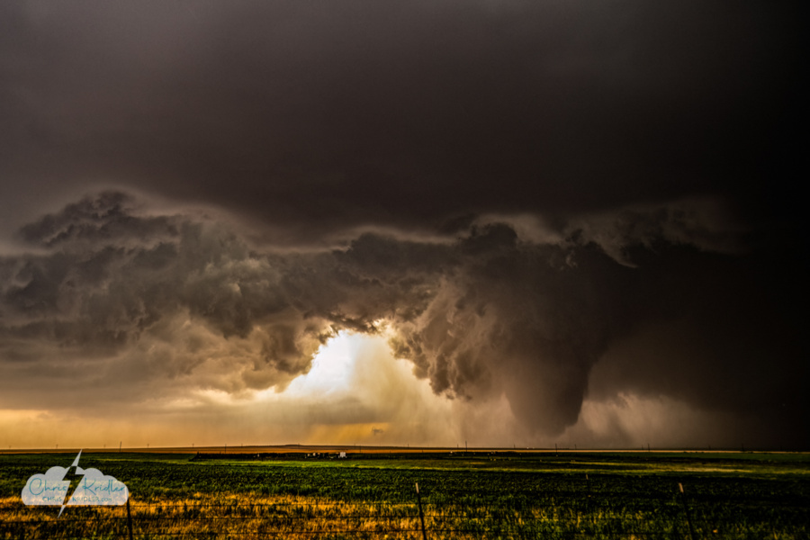
At 7:33, the fat tornado looked more like a wedge. At one point it was more than a mile wide, according to the National Weather Service.
It’s not unusual for chasers to have regrets about chases. Things happen fast, adrenaline is flowing, and you make a lot of decisions in the moment. Dave and Jason wish they’d sent up their drones. My regret was that I didn’t pay more attention to video. Alethea shot the whole thing on video, and her footage is awesome. At least my GoPro was on the dash, and in spite of raindrops and the occasional windshield wiper and chaser cameo, or maybe because of those things, which give the video a naturalistic vibe, the footage is kinda cool. I’m including the timelapse in my video report.
One thing I’m glad about, despite my scatterbrained videography, is that I looked at the tornado with my eyes and not just the lens. “Just take your eye away from the camera for a second,” Dave told Jason, though it was a good reminder for all of us. “Remember.”
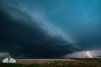
The storm seemed to exercise all its drama at once, and while we followed it for a while, it didn’t cycle up again into tornado mode. There was some really hot lightning that died down just after we found a place to shoot it. And then the chase was over.
I’m keen to see what’s learned from this storm, given all the research data and documentation by so many storm chasers. The tornado was probably in my top five, though I haven’t thought much yet about where I’d rank it. Just like I don’t actually count how many tornadoes I’ve seen. The ones that matter are the pretty ones I capture in a photo. And in this case, hundreds and hundreds of photos. It was truly an extraordinary storm chase.
The video is above, and in spite of my worries at the time, there’s quite a bit of tornado footage in it! To start a slide show with captions, click on any photo below.

