I’m reconstructing and enhancing this report ten years later as I move content over from the old SkyDiary website. This is still one of my most stunning chases. I only wish I’d had better gear and experience before I went into this day! But luck certainly had a hand in what we saw.
There was a lot of tough slogging in 2004 with few storms to chase in early May. After thousands of miles of driving over almost two weeks — which was about the span of my chasecation — and the bust of May 11, with its unfulfilled tornado watch, May 12 showed a lot of potential. And boy, did it pay off.
We started the day in Colby, Kansas. I drove Dave Lewison and me. With us were Scott McPartland and Pete Ventre in Scott’s car, and Mark Robinson, David Sills and Sarah Scriver in theirs. Our chase group (which Charles Edwards and others began to call “the Auto Club,” a la TWISTER) all agreed about southwest Kansas, though with variations on the exact target, from just east of Liberal on the Oklahoma border all the way to Dodge City and Pratt.
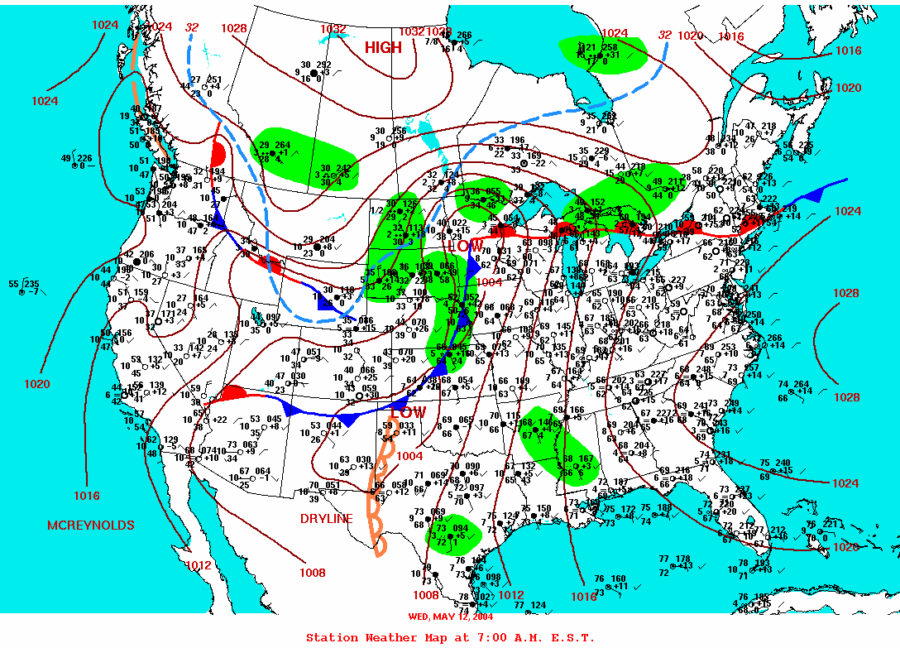
The Storm Prediction Center issued a slight risk of severe storms with a 5 percent tornado probability in our target area. The 1630Z discussion said:
..CENTRAL/SRN PLAINS…SLY FLOW HAS CONTINUED TO INCREASE GULF MOISTURE TO THE POINT WHERE THERE IS POTENTIALLY A VERY UNSTABLE AIR MASS S OF COLD FRONT AND E OF DRY LINE. A SUBSTANTIAL CAP WILL DELAY INITIATION UNTIL LATER THIS AFTERNOON. AS SURFACE LOW DEEPENS…SELY FLOW WILL INCREASE LOW LEVEL MOISTURE WWD INTO SERN CO. THIS WILL LIKELY BE AREA OF INITIAL CONVECTIVE DEVELOPMENT WITH ADDITIONAL STORMS ALONG COLD FRONT KS AND DOWN THE DRY LINE VICINITY OK/TX BORDER.
DEEP LAYER SHEAR OF 40-50 KT AND A VEERING HODOGRAPH IN THE SFC-1 KM LAYER..COUPLED WITH MLCAPES LIKELY IN EXCESS OF 3000 J/KG…SUPPORT A SUPERCELL MODE OF STORMS. PRIMARY THREAT WILL BE VERY LARGE HAIL HOWEVER AT LEAST ISOLATED TORNADOES ARE LIKELY IN AREAS OF ENHANCE LOW LEVEL CONVERGENCE AND SHEAR VICINITY DRY LINE AND COLD FRONT.
By 20Z – 3 p.m. central time – the discussion had updated with a greater tornado threat:
AIR MASS EAST OF THE DRYLINE HAS BECOME VERY UNSTABLE EARLY THIS AFTERNOON WITH MLCAPE BETWEEN 2000 AND 3000 J/KG ACROSS WRN AND CENTRAL OK INTO S CENTRAL KS. INTERESTINGLY…BRN SHEAR NUMBERS ARE 60-70 M2/S2 JUST ALONG/SE OF THE BOUNDARY AWAITING FOR THE WEAK CAP TO BREAK THAT IS STILL OVER CENTRAL OK. LATEST RUC MODEL INDICATES THAT CONVECTIVE DEVELOPMENT COULD OCCUR BY 00Z OVER CENTRAL KS…AND NEAR THE FRONT/DRYLINE INTERSECTION AFTER 00Z. POINT FORECAST SOUNDINGS INDICATE THAT BRN SHEAR VALUES WILL BE AROUND 80 M2/S2 INCREASING THE THREAT TO ISOLATED TORNADOES ACROSS EXTREME S CENTRAL KS/NWRN OK JUST EAST OF THE SURFACE LOW.
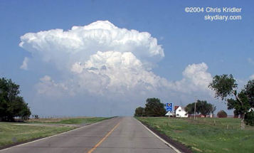
We stopped a couple of times to get data on the way, the last time in Meade. It was clear we were behind the dryline/front, with low dewpoints in the mid-50s. The storms would fire on the dry push bulging out east ahead of us, we were sure, and a few CU (cumulus clouds) were starting to go up there. Once we headed east and saw the small line starting to form, we were encouraged to see the kind of explosive convection we were longing for. One of the cells began to dominate, bubbling upward and outward in hard, white billows. Then a tower to its south began to swell, too, soon becoming a rival storm. It appeared the northern storm was splitting as we tried to reach them both from the west side, not the best way to intercept an east-moving storm. Plus, with the explosive upward development, we felt sure we would be tangling with some big hail as we tried to get through.
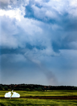
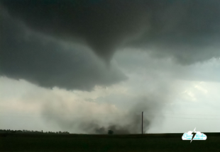
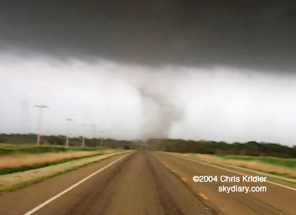
We stopped briefly on route 160, our road for most of the chase, and got a couple of shots of the hard anvil on the back side of the northern storm. Then we resumed our pursuit. We were starting to see storm chasers everywhere, as well as mobile Doppler radar trucks. Then, things started to get interesting. The storm to the north appeared to have some nice rotation at its base, possibly even a funnel. We heard that a storm spotter reported a tornado, though I didn’t see it. Mark and his crew dropped back to check it out. The rest of us were farther east, filming the northern storm, when I heard someone say over the scanner that there was a tornado. I was kind of puzzled, then saw the DOWs (Doppler on Wheels) and other cars screaming eastward. Dave L. turned around and saw that the storm to our south was producing a slim, white tornado.
It lasted several minutes, sending up a plume of red dust at its base. We knew we had to get east so we could catch the storm’s next cycle. Mark was unreachable by radio. There was nothing to do but go on. Dave and I went forward in my Honda Element, followed by Scott and Pete in Scott’s Nissan.
We hauled east to get into position.
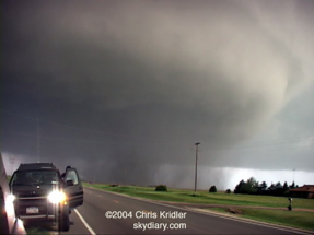
It was clear immediately that we were in for some stress, to put it mildly. First, there was a core to contend with, the part of the storm that contains most of the rain and, in the big boys like this one, the hail. Over the cell phone, our nowcaster, Jason Politte, suggested the core was mostly north of the road — but he could be off by a mile or two. Oh, boy!
There was a lot of rain, at first. Then the big hail started, golf balls and baseballs. Some of the baseballs were spiky. As we came into the town of Attica, Kansas, the sirens were screaming. I was making little fearful exclamations, as mentally I was reliving the 2001 hail-trashing of my CR-V. For about a block — literally, we circled the block — we tried to find a hail shelter, then realized that with the big, black mesocyclone to our south, we almost had to go on. Either we would sit there and get trashed by hail, possibly in the path of a tornado, or we would try to get out of the “hook” of hail wrapping around the rotating meso and also try to get ahead of the meso itself.
As we came out of town, we heard Charles Edwards of Cloud 9 Tours talking about a tornado over the scanner. It soon became clear that there was a funnel, with dust on the ground, as we got to the east edge of town. Now, which way to go? If we sat on the west side of the meso, we’d be crunched by hail and even more hail as the storm moved east, possibly blocking our view, not to mention trashing our cars. We chose, perhaps a bit unwisely, to go farther east.
This was a most amazing place to be. Not everyone chooses to chase a storm on the north side of a mesocyclone, since there is often hail (and believe me, there was – it’s a miracle we didn’t lose windows or have bigger dents), blindingly intense lightning like the bolts we saw, and, to make things worse, potentially north-moving tornadoes. We stopped directly north of the bulging funnel under the meso. Dust swirled beneath it. We could actually HEAR IT. A tornado doesn’t sound like a freight train when it’s not full of debris. It sounds like a waterfall. It was quiet, and beautiful, and scary. (The tense dialogue in the video is amusing in retrospect.)
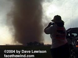
The funnel elongated, then filled in. The tornado was moving our way. We zipped east, then got out of our cars for a few minutes to film it. Baseballs were still whizzing by us now and then. I actually put on my pith helmet (I almost keep it in the car as a joke for hail — but it was no joke this time).
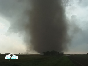
Suddenly, Scott shouted that the tornado, now so huge it would not fit into our video frame, was going to hit a house on the other side of the road.
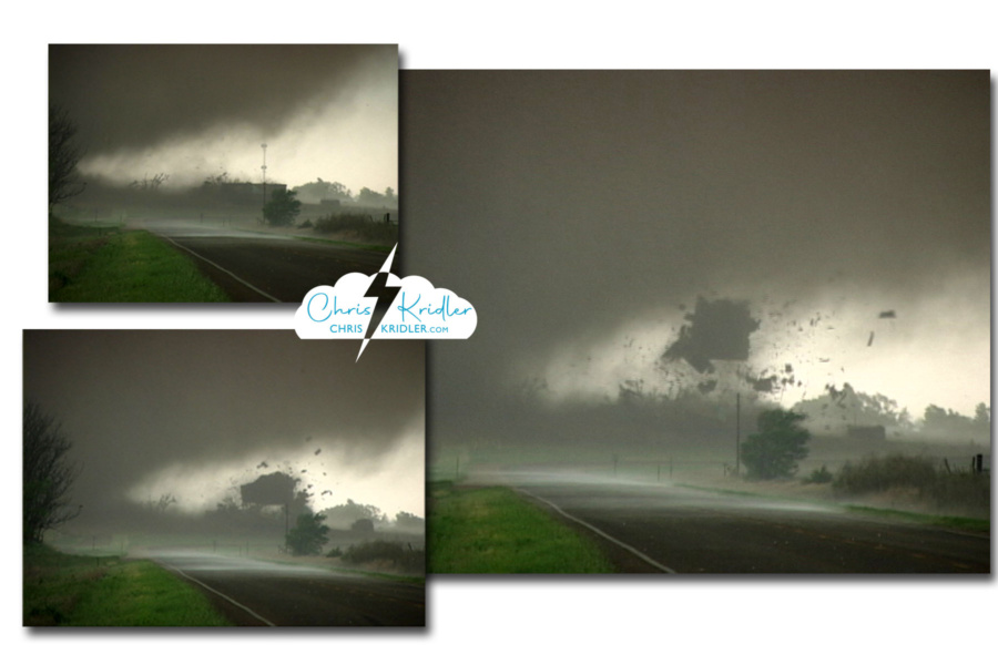
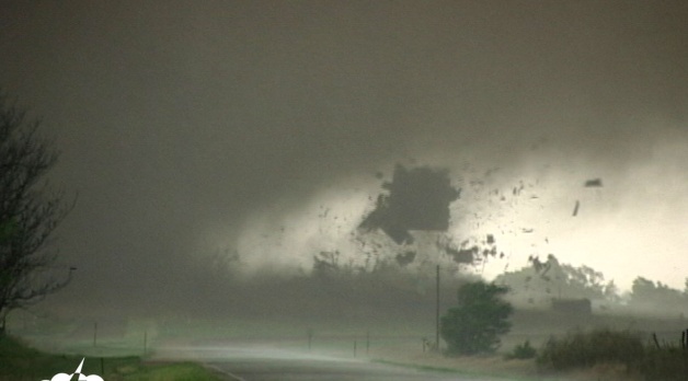
Three video grabs show the tornado tearing the roof off a house. We called a friend to notify emergency services as we got out of the way.
As we faced west, the tornado crossed the road, and the house seemed to explode in the ripping winds. The roof flew off and was sucked up. Debris flew everywhere, though not near us; we were less than a mile away. All of us were filming. We zoomed in on the destruction and caught it on video. The next day, we heard no one was inside, but we have since learned the family was at home and survived in the basement. Right after it happened, Dave called Jason to have him call in the event to the Harper County emergency services as we were not in a safe position to go back. The National Weather Service later reported, “This tornado was rated as an F2 due to the complete loss of the roof, two barns being destroyed and slight realignment of the vehicles.”
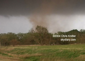
The tornado continued to spin north of the road, and the baseball-size hail was catching up to us. But this was a cyclic supercell, and it was about to do it again. We chose to continue east on 160. The meso stayed south of the road. I cried out that dust was already on the ground under it, behind a row of trees. It was the start of the next tornado.

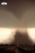
The third tornado of the day passes just to our south.
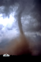
We got just north of this one, too, and parked in a tiny gravel road so that we could face it and videotape it. It formed an elegant funnel with a cloud of debris underneath, in a bright green field next to a red-earth road. It was backlit and looked almost black. It crossed some power lines, so gracefully, and suddenly, too close for comfort. We feared that it, too, would move north and on top of us. Time to move.
I turned left and sounded the alarm. A satellite tornado blocked our escape route, to the east of our cars, right on the road and coming our way! Satellite tornadoes can spin around the outside of the area of rotation and can move much faster than the main tornado. I put on the brakes, trying to figure out which way, if any, was safe to move. That tornado sort of evaporated while another satellite formed behind it, ripping into some trees, a thin but powerful swirl of red dirt. As soon as it moved off and dissipated, I hit the gas and we got the heck out of the bear’s cage.
Dave got some impressive footage of the main tornado — again, about a quarter-mile away — outside the passenger window as we sped east. Obviously, I couldn’t film that and drive at the same time. We turned north and paused to look back at the smoothly sculpted meso and tornado. The funnel was half-hidden in rain curtains. Hail fell around us, and lightning zapped nearby.
I was in full “flight” mode at this point after dodging the satellite tornadoes, but in retrospect, I wish we had stopped here a bit longer. The National Weather Service recorded F4 tornado damage just east of where we were at this moment. Though I’m not sure we would have seen the tornado even if we’d maintained a position north of it as precip got in the way and darkness encroached.
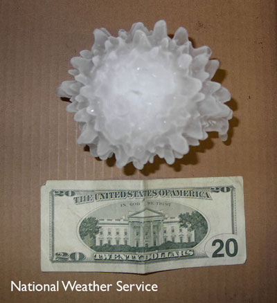 Our priority became getting out of the path. We also had to navigate out of the hail, so we headed east out of Harper. Check out this NWS photo of 5.24-inch hail from this storm!
On our way east, we saw a burning tree, the fire possibly caused by lightning. Later, we photographed lightning from a safe distance and met up with Mark’s party.
Things happened so fast, with so much adrenaline flowing, I was grateful for the video so I could review the sequence of events. And Dave made a great map reconstructing our route in conjunction with the tornadoes’ paths. The National Weather Service in Wichita documented 11 tornadoes in central Harper County on this day.
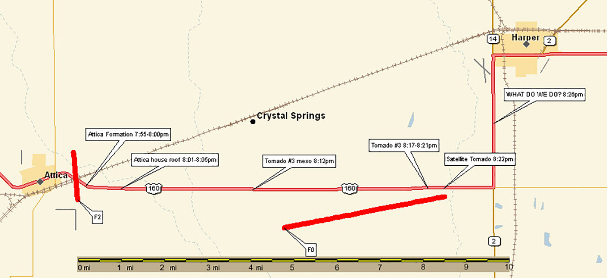
Map constructed by Dave Lewison of the Attica tornadoes and our timeline and path.
Click on any image to start a slide show. Note – in some cases these are video grabs from pre-HD video. The few slides I shot have that fuzzy retro feel partly because of the slow shutter speed. Ah, technology!

