
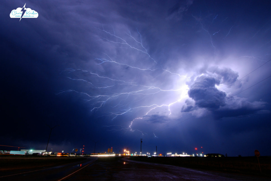
Lightning May 12, 2009, in Childress, Texas.
I have extensive archives from my early storm chasing years. I chronicled almost every day on the road, even bust days, at the old SkyDiary site, with lots of photos. In the interest of collecting everything in one place, I’m moving the highlights of the older chases – or quirky moments worth remembering – over to ChrisKridler.com. With that in mind, this post collects just a few of the accounts from 2009 and select photos to accompany them.
May 2, 2009: I began my trip to the Plains to chase storms, never dreaming I’d actually be chasing on Day One during my long drive from Florida. I saw a couple of tornado-warned storms in Mississippi, but no tornadoes. I drove over 900 miles on this day, and a ridiculous number of hours after leaving home at 5:30 a.m. EDT.
May 3, 2009: I woke up in Jackson, Mississippi, on May 3 to the first wave of squalls hammering the hotel. After a snooze, I got up about an hour later and saw a huge bow heading our way on the radar. I was out of the hotel by 9 a.m. and heading south on I-55. It looked like a cell was forming ahead of the line. I dropped south, then, trying to intercept the tornado-warned advance cell, made a problematic decision to take a tiny, windy road northwest into what was essentially a forest.
I started to make my way toward a main road and saw lots of branches and some trees down. This was in a rural area west of Hazelhurst. I was so close to the main road when … yep, a tree down, blocking my way. I thought that might happen. Here I am checking out the fallen tree. My superpowers failed to manifest, so I had to leave it, turn around and find another way out. I gave up the chase and headed west.
May 5, 2009: My initial target was somewhere between Abilene and Seymour, Texas, where the dryline push and warm front were likely to intersect and where upper-level winds would enhance storms. I would refine that forecast on the road. I left Amarillo in the mist and cold and, after a data stop in Childress, I dropped south.
I found the Cloud 9 Tours group in Aspermont, so I goofed around with them for a while as I kept an eye on the clearing satellite picture. I left the Cloud 9 folks because I wanted to get a little southeast, where the forecast suggested storms might fire, and near the field of cumulus clouds near the warm front. This is east of Anson. At first, they weren’t much to look at. Soon, the clouds starting percolating in the afternoon heat and began to form a nascent storm, here seen from a picnic area that overlooks Hubbard Creek Reservoir, west of Breckenridge. From Breckenridge, the tower looked solid. At this time, I began to see massive chaser caravans.
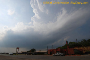
Here’s a view of the base, as seen from Breckenridge.
Though the storm became disorganized, the towers at its southwest end began building and dominating. This is just east of Breckenridge. I ran into the Cloud 9 group again. We were among dozens of chasers (at least) who were following the storm.
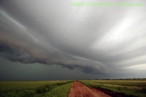
I repositioned and got a nice view of a wall cloud forming. It began rotating as small hail began falling around me. Driving through the hail was stressful, but I stayed ahead of the bigger stones, despite a lot of banging on the car. The reward: this beautiful rotating wall cloud crossing Interstate 20 at Route 16.
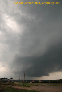
The rotation made it seem likely a tornado was imminent.
Driving through the hail was stressful, but I stayed ahead of the bigger stones, despite a lot of banging on the car. The reward: this beautiful rotating wall cloud crossing Interstate 20 at Route 16.
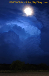
The National Weather Service cited a preliminary storm report of grapefruit-size hail – 5 inches across – with this storm, just north of our location, and it was moving southeast. I bailed and took shelter, but I missed the worst of the core. A baseball-size stone cracked John Guyton’s windshield. Meanwhile, I got a few shots of the retreating storm and the rising moon.
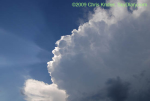
May 8, 2009: Most of today was frustrating. I began the day in Bartlesville, Oklahoma, and decided the front and the monster convective potential suggested southeast Oklahoma might be the place to catch storms today, or somewhere along the Red River between Oklahoma and Texas. I made the long drive down to Durant, Oklahoma, on the border, had a late lunch and pondered my options. I decided I needed to get a little west, closer to the front, and also wanted to keep an eye on a line of cumulus clouds developing in clearer air in Texas. Those started to pop, and I made the decision to go south. A while later, I decided I didn’t want to bother with those south-moving hailers, especially because it might take a while to catch them – yet a tornado was reported from one of them in Early, later. Meanwhile, a line of storms was going up to my west, so I checked them out. The result was beautiful.
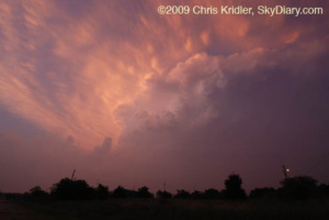
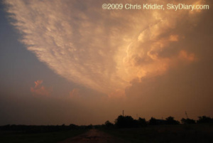
Storm on fire!
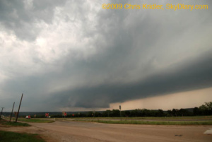
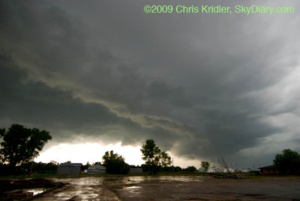
May 12, 2009: What a crazy drive today. I started in Woodward, Oklahoma, and at first thought about an Oklahoma panhandle target. But as the day wore on, the models’ meager forecast of precipitation there evaporated, and it seemed like the southwest Texas panhandle would be more likely. Thanks to Steve Sponsler for data updates.
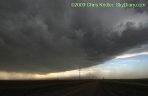
Though it looked ominous, the storm appeared linear and unlikely to produce a tornado.
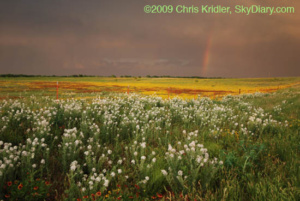
More flowers and another rainbow near Estelline, Texas.
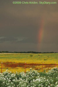
A rainbow closeup.
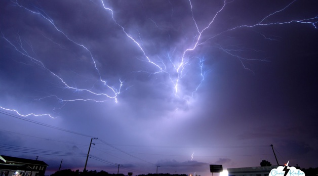
Mammatus and lightning northwest of Childress.
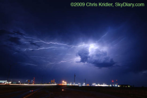
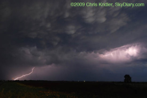
Lightning over Childress.
Instead of watching this pretty thing, I probably should have been driving east and getting ahead of the storm…
May 15, 2009: It seemed clear that there would be storms today, and that they would likely develop rapidly into a squall line once they fired. I thought about a couple of possible targets – the Texas panhandle, where storms could be more isolated on the dryline, and the Kansas-Oklahoma border near Alva, which was not an unreasonable drive (always a consideration) and also had enough upper-level support and huge convective potential to make me think something interesting might happen there. Eventually, there was a tornado reported in the panhandle, but I had cast my luck with northern Oklahoma.
Beams of light and pretty convection.
Sweeping in.
Looking to the north.
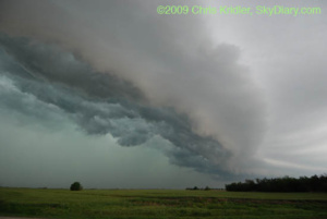
May 26, 2009: Florida is king of the shelf clouds. Here’s a beautiful layered gust front approaching the Brevard County coast from the west.
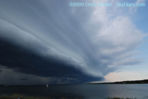
The shelf cloud looms.
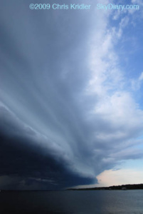
Beautiful layers appeared in the shelf cloud.
June 22, 2009: After days of unusually high temperatures of high 90s in the shade, the Storm Prediction Center put Brevard County, Florida, in a severe thunderstorm watch this evening. Storms broke late and brought with them nice lightning as they moved in fast from the north.
Lightning shot from Cocoa Beach, looking west, on June 22, 2009.
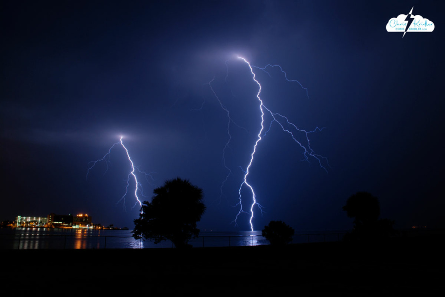
July 24, 2009: The evening began with a farewell to my husband’s brother – a memorial at Lone Cabbage Fish Camp in Cocoa, Florida. Then the skies opened. I had my camera, so when the gathering was over, I sought out the storm. This was one of the best nights I’ve seen for lightning in a long time here.
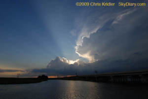
The storm cluster became more vigorous as it slowly edged closer, as seen over the St. John’s River.
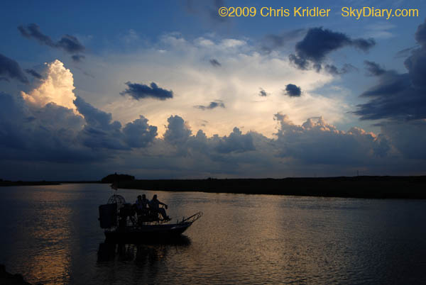
The sunset and storms provided a classic Florida scene as this airboat tried to get going at the Lone Cabbage Fish Camp.
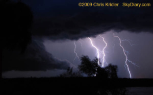
More bolts spring from the approaching storm.
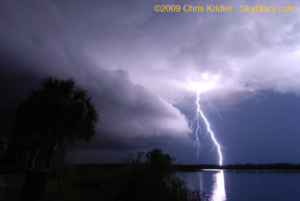
I love the reflection of the lightning in the water. I think this is my favorite photo from this stage of the evening. This is full-frame, not cropped.
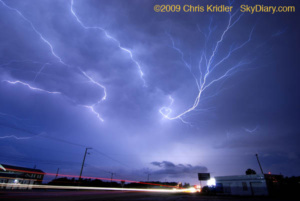
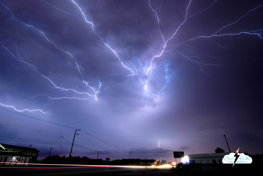
More great color and light – crawler above, traffic below.
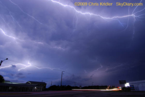
These just seemed to rip across the sky.
August 22, 2009: Hurricane Bill took pity on Florida and swept on by, but it delivered a boon to surfers in the form of big waves. Here are some shots on a beautiful beach day at the south end of Patrick Air Force Base (Satellite Beach).
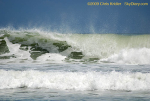
Whipped cream and emerald frenzy.
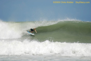
In the tube!

The arc.
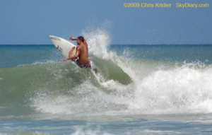
Taking off.
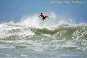
Airborne!
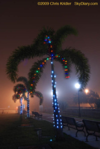 December 14, 2009: A fog event right out of a science-fiction movie rolled into Brevard County on Dec. 14. When I drove to the barrier island in the late afternoon, the fog seemed to be enveloping only the beach communities. Then it moved inland. I got just a few photos in Cocoa Village of the Christmas lights in the fog.