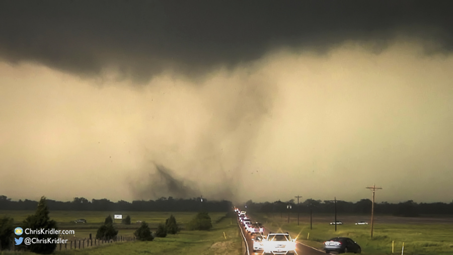
A multivortex tornado chases the chasers down the highway in northern Oklahoma on May 10, 2010. Photo by Chris Kridler, ChrisKridler.com
I have extensive archives from my early storm chasing years. I chronicled almost every day on the road, even bust days, at the old SkyDiary site, with lots of photos. In the interest of collecting everything in one place, I’m moving the highlights of the older chases – or quirky moments worth remembering – over to ChrisKridler.com. With that in mind, this post collects just a few of the posts from 2010 and a few photos to accompany them.
Jan. 6-10, 2010: Several nights of freezing temperatures shocked central Florida and its plants at the start of January. I caught a few photos of sleet and ice – a very strange thing to see in Brevard County.

On Jan. 6, 2010, our fountain froze, as it did many days during the cold snap.
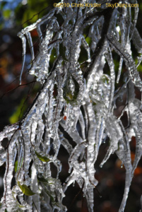
I have to thank the neighbors and their gratuitous use of a garden hose for this ice sculpture Jan. 10, 2010, in Rockledge, Florida.
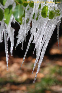
A shifting branch during the melt meant crooked icicles Jan. 10.
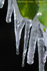
Another look at the neighbors’ ice fantasy – when hose meets tree meets freezing temperatures on Jan. 10, 2010.
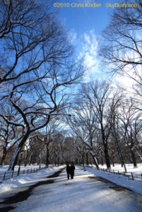
Feb. 11-12, 2010: Right after one of New York’s Snowmageddons this winter, I got some snowy shots in and around Central Park.
It’s better to walk with a friend…
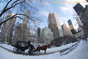
Hard-working horses.
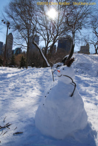
A snowman suns himself.
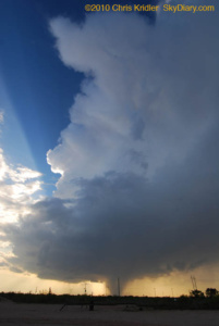
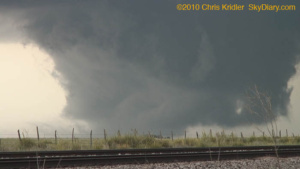
May 10, 2010: This was one of those absolutely nuts, off-the-hook storm days. The models had suggested it was coming for days, so every chaser and media person you can imagine was out to see the disaster in the making. Then the Storm Prediction Center issued a high risk of severe storms, including strong tornadoes. The big problem for chasing: They were expected to haul butt northeast at highway speeds, meaning you couldn’t really chase the storms very well – you had to put yourself in front of them and hope. I started the day in Norman, Oklahoma, and picked Ponca City as a preliminary target. I ended up meeting up with Scott McPartland, Dave Lewison, Mark Robinson and Mark’s crew of meteorology types in Blackwell, in north-central Oklahoma, and we went after a storm that went up near Woodward. (From home, Steve Sponsler and Cheryl Chang both said it split.) We caught it as it put down a brief but pretty tornado. Churning east, suddenly, instead of northeast, it then put down a multi-vortex tornado. I regret not getting more video or stopping for longer than a few seconds, but it literally chased about a hundred chase cars down Route 11 at about 55 mph. NOT a good situation. As it finally eased north of the road, the radar hook on it indicated a big (if unseen and rain-wrapped) tornado. After that, I did a lot of stair-stepping east of I-35, trying to catch another storm, but it was darn near impossible. I hope my next chase is a slow one. Many, many tornadoes occurred today, costing lives and causing damage. It was a tough day and a sad one.
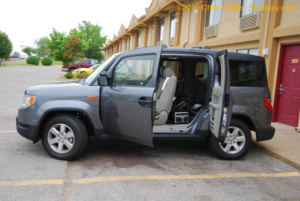
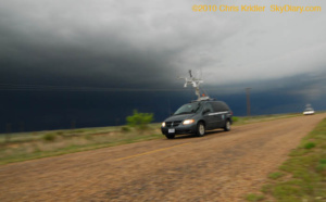
My new Element was ready to go on its first storm chase.
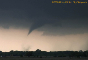
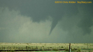
A tornado touches down briefly southwest of Wakita, Oklahoma (that’s the town destroyed in the movie “Twister”).
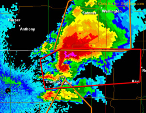
When I finally got far enough east, I grabbed a frame of the radar showing the storm’s classic hook, indicating a big tornado. If there, it was wrapped in rain. I’m the dot in the circle.
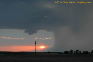
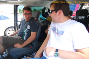
May 11, 2010: There are more people pictures than sky photos in this summary, because this was a classic storm chase in the sense that we ended up waiting around a lot for the cap to break. Today I took along a friend for her first chase, Tiffany Crumrine. We chased with Scott McPartland, Dave Lewison, Mark Robinson and crew, and met up with various folks along the way before becoming separated from them all (except for hearing them over the radio). What seemed like a significant storm potential and a lot of juice went to waste before sunset with little in the way of storms – except one pretty, tornado-warned corkscrew, below.
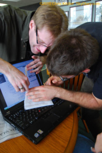
Mark and Brad use a knife and a napkin to properly read a hodograph during forecast discussions at the Guest Inn in Norman, Oklahoma.
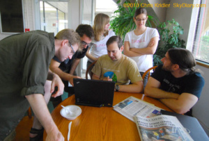
Further forecast discussion at the Guest Inn. Note the newspaper on the table with headlines about the previous day’s tornadoes.
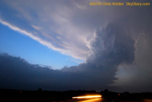
Here’s a parting shot of the storm, which soon shrunk out of existence.
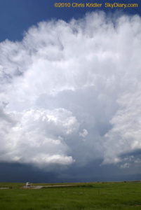
May 12, 2010: Any hopes for isolated storms today were dashed pretty quickly once the line went up. A few remained discrete for a little while, and we followed one from Alva, Oklahoma, into Kansas, but we missed the rare tornadoes today. I chased with Scott McPartland and Dave Lewison, and Mark Robinson and his crew.
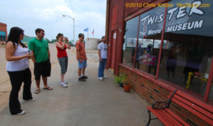
We made a stop at the Twister Museum in Wakita, Oklahoma, on the way to a chase target farther west.
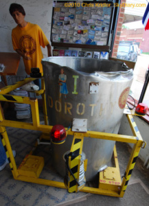
The Twister Museum holds “Dorothy I,” the prop from the movie “Twister.”
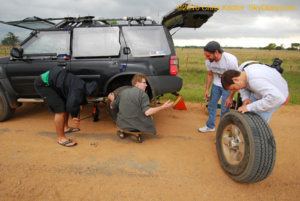
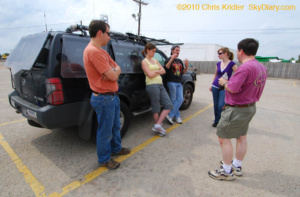
Brad, Mark, Scott and Dave snapped into action to change a tire before the line of storms could overtake us.
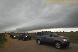
Our caravan lines up to watch the outflow boundary in motion.
May 16, 2010: I was on my own today. I drove from Carlsbad, New Mexico, to Odessa, Texas, and got an oil change, expecting that I might have a chance to chase whatever popped up later in that area. But by the time I was done, the biggest severe storms were going up in Oklahoma. That was out of reach, and I liked the boundary and bit of moisture convergence in eastern New Mexico, near Clovis. I started heading in that direction when just a few compact storms started to pop. Despite less than ideal conditions, a couple went severe, slowly moved southeast, and made for a fun and photogenic chase.
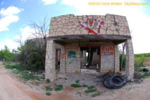
One can imagine this building’s better days.
The hail shaft had a deceptive, tornado-like appearance.
The heavy precipitation core, the sunset and a nascent wall cloud.
May 18, 2010: I started the day in Lubbock, Texas. It seemed to me the best conjunction of moisture, wind profiles and other factors pointed to the Oklahoma-Texas border in the northwest Texas panhandle. As I drove into Amarillo, I heard the old crew (Dave Lewison, Scott McPartland, Mark Robinson and friends) on the radio and met up with them and with Bill Hark in Dumas. We went to Dalhart to wait for a likely storm, and a blip on radar near Dumas quickly became an amazing, isolated supercell. Our crew split up, but I met them later. I say I saw “at least one” tornado today because one was obvious. Another sure looked like one, but I’m waiting for confirmation. And who knows how many I filmed in the dense hail/rain core without knowing it. There were a lot of “scud bombs” hanging from the storm that probably prompted reports, too.
Bill Hark, right, flew in from Virginia for the chase. We waited around Dalhart, Texas, until the first blip went up on radar.
At this point, the wall cloud may have been on the ground – that is, a tornado! My video shows strong rotation, and a series of video grabs shows what looks like dust on the ground. I can’t confirm it was, however, because I wasn’t close enough.
If it wasn’t a tornado, it should have been.
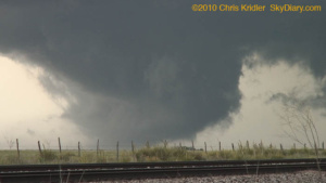
Then the storm formed an unquestionable tornado.
A Vortex 2 probe zooms down a ranch road near Stinnett, where a large tornado was reported in the precip core as the sirens blared.
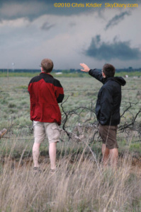
Mark and Brad scan the storm outside Stinnett at dusk as we let it slip by.
May 19, 2010: I started the day with Scott McPartland, Dave Lewison, Bill Hark, Mark Robinson and crew in Shamrock, Texas. We drove to Weatherford, Oklahoma, to wait for storms to fire. A couple did and almost immediately produced tornadoes, but we were nowhere near them – and then, as the storms went more high-precipitation and we caught up with the one near Leedey, it provided awesome structure but not much in the way of tornadoes unless you were in the hail or flying a news helicopter (one got great footage of a tornado near Kingfisher). It was still a fun chase. We split up as we caught up with the storm. I chose to stay south of it and got some nice pictures of the rotating mesocyclone, the hail core and a funnel west of Guthrie, where the tornado sirens were screaming as I drove through. I ended the day with a fantastic sunset in Arcadia, as the storms moved east and my Plains storm chase winds down.
Brad and Dave discuss their options.
We caught up with this storm near Leedey shortly after it produced a tornado. The convection was impressive.
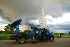
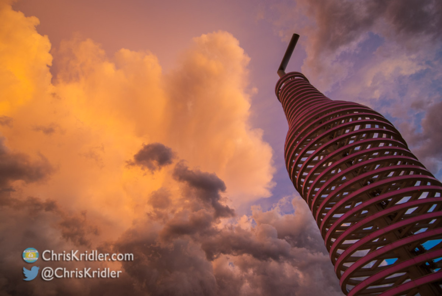
I stopped at Pops in Arcadia, an awesome gas station/restaurant/shrine to soda (with 500 types). Josh Wurman was getting interviewed in front of the giant bottle sculpture.
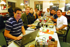
Our group met up again in Shawnee to share tales of hail, tornadoes, muddy roads, and chaser follies.
Pops on old Route 66 northeast of Oklahoma City on May 19.
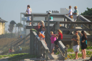
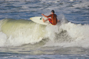
September 2, 2010: It’s been an excruciatingly dull summer in terms of weather, but distant Hurricane Earl generated photogenic waves off east-central Florida as it neared the Carolina coast. These shots were taken in Satellite Beach.